Politics & Government
Update: Mercer Island Under Wind, Flood Advisory With Rain in the Forecast
The National Weather Service has issued wind and flood advisories for early Saturday for the region.

Update, 5:40 p.m. Friday:
We may be thawing out, but now comes the threat of strong winds and urban flooding.
The National Weather Service issued a wind advisory for most of Western Washington from midnight Friday until 10 a.m. Saturday.
Find out what's happening in Mercer Islandwith free, real-time updates from Patch.
From the advisory:
Southerly winds of 20 to 30 mph with gusts to 45 mph will develop after midnight tonight and continue Saturday morning. Impacts: gusty winds may snap tree branches and cause local power outages. Areas with tree and limb damage caused by the ice storm may see numerous additional falling limbs. Beware snags which are likely to fall when the wind increases overnight.
Find out what's happening in Mercer Islandwith free, real-time updates from Patch.
And an urban and small stream flood advisory for rain and melting snow is also in effect in much of the region, including King County, until 3:30 p.m. Saturday.
“Light to moderate rain” is expected over the entire area Friday night and Saturday. The Weather Service says to expect ponding on roads and in neighborhoods. And all that water means the possibility of landslides is greater, too.
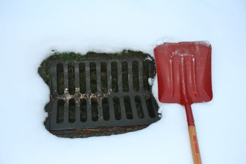
So hold onto your hats and clear your storm drains. And let us know how you’re faring this weekend in the comments below.
--
A flood watch is in effect for Mercer Island and the Seattle Metro area Friday through Saturday, and the National Weather Service (NWS) says rain in the forecast could cause flooding in urban areas and small streams.
"All areas could see excessive surface runoff with ponding of water," read the flood watch statement. "Ponding around clogged drains or culverts ... And/or small streams going over their banks. Worse area flooding could occur in spots."
Mercer Island Assistant City Manager Glenn Boettcher said city maintenance crews were continuing to plow arterial roads and had on the Island as of 10 a.m. — except for East Mercer Way and SE 53rd Place, which are closed due to downed power lines. Snowplows have returned this morning to the Town Center business district to clear away an accumulation of slush as the rain begins to thaw the snow and ice.
"We're trying to keep plugged-up catch basins clear and we'll have to rely on nature to take its course and help us," Boettcher said. "Flooding happens on Mercer Island when catch basins are blocked or more than the underground system can handle. It's flooding in the street. We urge people, if you see a catch basin that obviously isn't draining to please do your best to unplug it."
The NWS is urging residents to stay alert and monitor the latest forecast on TV, radio or Internet. A flood watch means that conditions for flooding are likely but not imminent.
As road conditions improve, Mercer Island road crews will be shifted to addressing runoff. Mercer Island has many areas prone to landslides and driving conditions will remain hazardous at least for the first part of the day.
Rivers and creeks across King County are expected to rise as rain melts accumulated snow, and a wet storm system moving in this weekend could push major rivers to flood levels.
Stay on top of the Winter Weather and snow at Mercer Island Patch by checking our Winter Weather topic page, found by clicking here.
Here is the National Weather Service’s pinpoint forecast for Mercer Island:
Today: Rain. High near 42. Southeast wind between 7 and 11 mph. Chance of precipitation is 100%.
Tonight: Rain. Low around 42. Southeast wind around 15 mph. Chance of precipitation is 100%.
Saturday: Showers likely, mainly before 10am. Cloudy, with a high near 46. Breezy, with a south southwest wind between 20 and 29 mph, with gusts as high as 40 mph. Chance of precipitation is 70%.
Saturday Night: A 40 percent chance of showers. Mostly cloudy, with a low around 38. South southwest wind between 10 and 13 mph.
Helpful Tips:
- Consider options now for travel, staying off the roads if possible.
- Move cars off streets, if possible, to aid with snow removal.
- Check on neighbors, especially the vulnerable.
- Wrap pipes and outdoor faucets to prevent ruptured pipes and flooding inside homes.
- Turn faucets to a slow drip to prevent pipes from freezing.
- Be careful how they choose to heat or light their homes. Open flames and unattended candles are dangerous. Do not bring open stoves or gas grills inside as the fumes can be poisonous and deadly.
- Find and Clear Street storm drains. Snow followed by rain can clog drains and cause flooding.
- Have coats, hats, gloves and blankets at hand to stay warm during possible power outages.
- Bring pets indoors.
- Only call 911 in a life-threatening emergency.
- The following is a directory of non-emergency help lines: http://www.kingcounty.gov/LinksByZip
Get more local news delivered straight to your inbox. Sign up for free Patch newsletters and alerts.